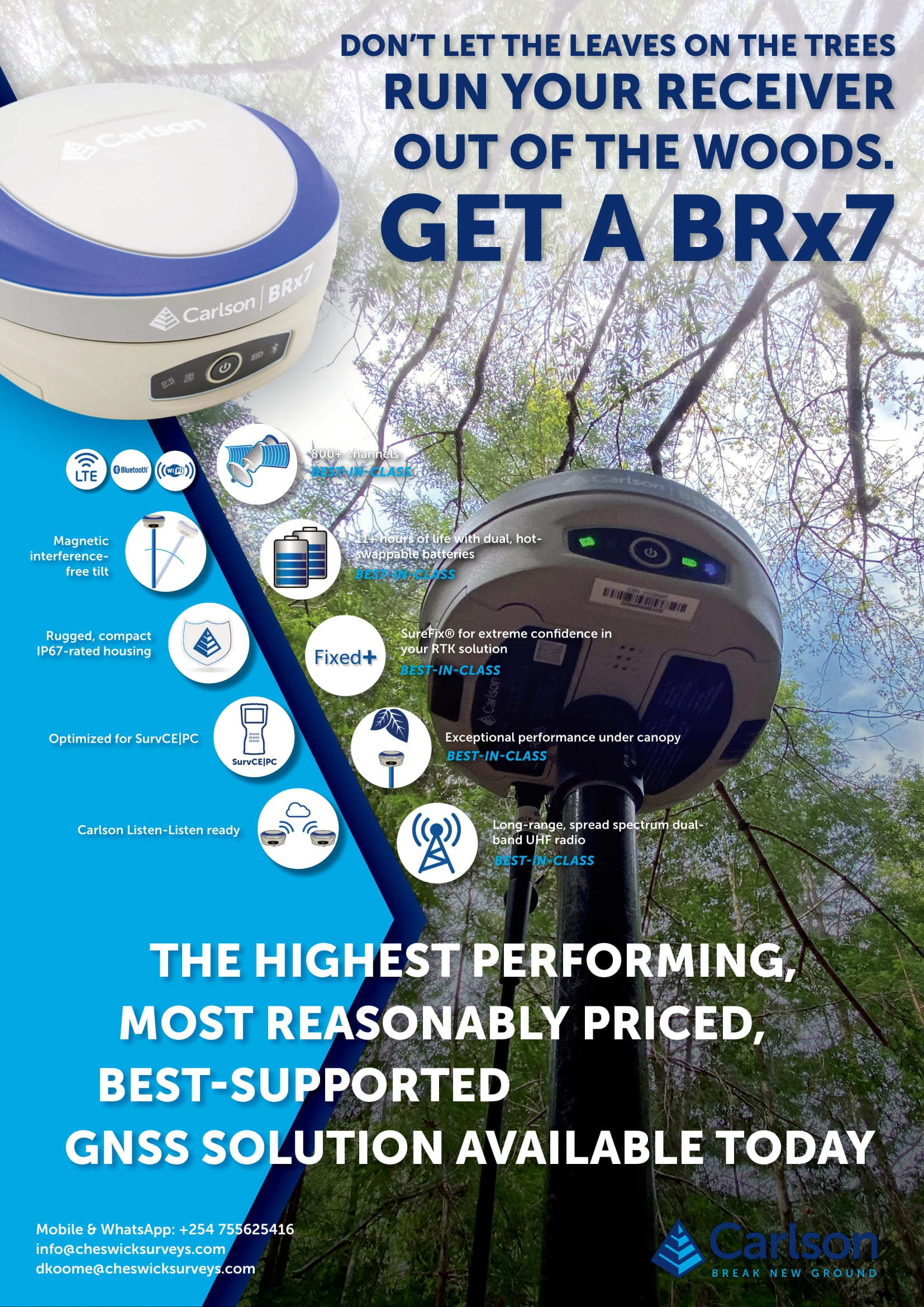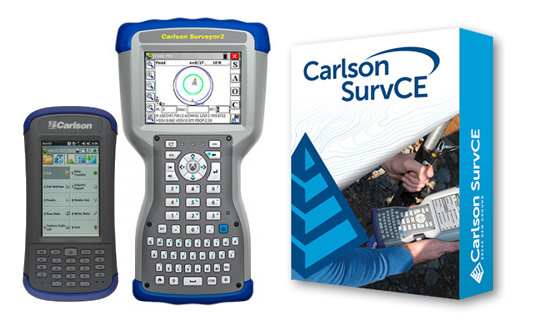
Carlson SurvCE is a data controller software that is a household name in the land surveying fraternity. As a matter of fact, most GPS OEMs prefer using Carlson as a third party software as opposed to coming up with their own. This speaks volumes about the user-friendliness and popularity of SurvCE.
The launch of Version 6 has brought with it some cool features that are bound to make fieldwork a lot of fun.
Red Tolerance Bar
When working out in the field with specified tolerances from the equipment menu, if the tolerances are exceeded, the status bar turns red in real-time. This is especially useful when doing a stakeout routine in harsh environments when the GPS is still in Fix Solution but the accuracy is questionable because of high tolerances.

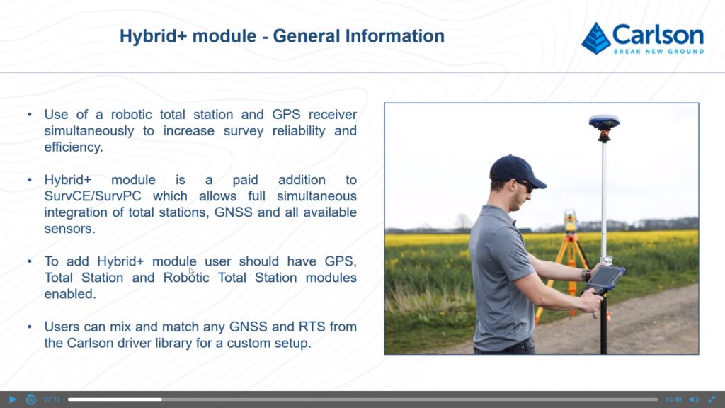
Hybrid Plus Module
This is a module that smoothens the operation of a GPS receiver and Total Station working simultaneously.
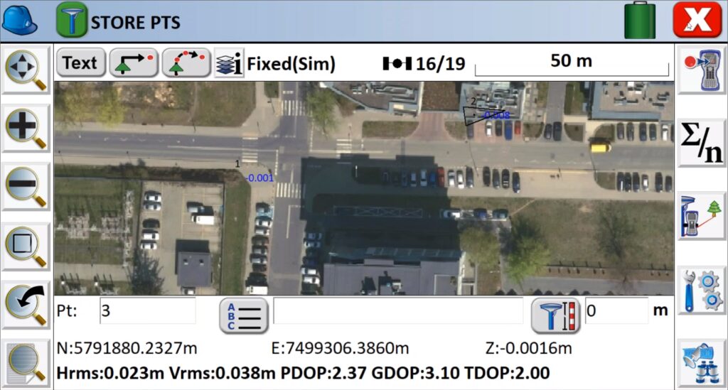
Web Map Overlays
This is my favorite feature. It enables a user to load online maps such as Google maps on the data controller and picked data is viewed on the platform. A user can also load other maps from web mapping services such as geo-portal which makes the surveying experience more engaging and fun.
Electronic Bubble Offset Method
SurvCE 2020 comes with an easier offset method for GPS receivers with an electronic bubble feature. The amazing thing is that a user does not need the magnetic sensors calibrated to use this feature. Only the electronic bubble needs to be calibrated. A user will now be required to tilt the pole in different inclinations at a particular point after indicating how many readings they want for the same point. They will then be required to press “Measure” the number of points specified after which the average reading of the said points will be displayed, complete with the standard deviation.

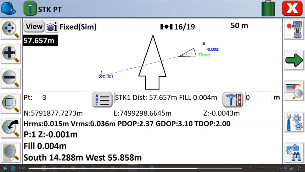
Proximity Stakeout Method
During the stakeout routine, SurvCE has introduced an arrow that points to the direction of the stake. The arrow sits in the middle of the interface and when the direction is changed, the arrow points away respectively to the direction the user is moving with respect to the staked point.
Carlson Cloud
This feature enables a user to share data with anyone without having to download the data via a computer and sending it afterward. This will enable survey teams to send data to the office without taking unnecessary breaks.